El Haseiat, 1:250000 Scale (military map)
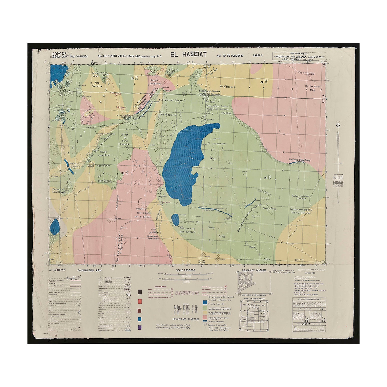
AnonOriginal Second World War rolled map of El Haseiat, scale 1:250,000. Egypt and Cyrenaica: sheet 9 / compiled, drawn and reproduced by 512 Field Survey Company Royal Engineers, Oct. 1942, with air information as supplied by H.Q., R.A.F., M.E. (I), July 1942. This military map shows the area around El Haseiat, southeast of Ajdabiya, in northern Libya, including populated places, tracks, named landing grounds, ruins, graves, salt lakes, wadis, wells and other water sources, sand dune areas, vegetation and terrain features. A higher resolution image is available to view on request.
