
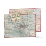
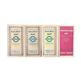

Four London Transport folding Railway/Underground maps, 1937-1939
Geographia LtdFour different London Transport folding Railway maps: No.1 1937, No.1 1938, No.2 1938 and No.2 1939
The maps unfold to show a geographic representation of the Tube network, with smaller maps of the central London area on the reverse.
Higher resolution images are available for viewing on request.
