Original folding Map of the Great Western Railway,  c.1925

The map unfolds to show the company's rail network and steamer routes, with detailed inserts for Birmingham and District, Isle of Man, London & Suburbs, and South Wales.

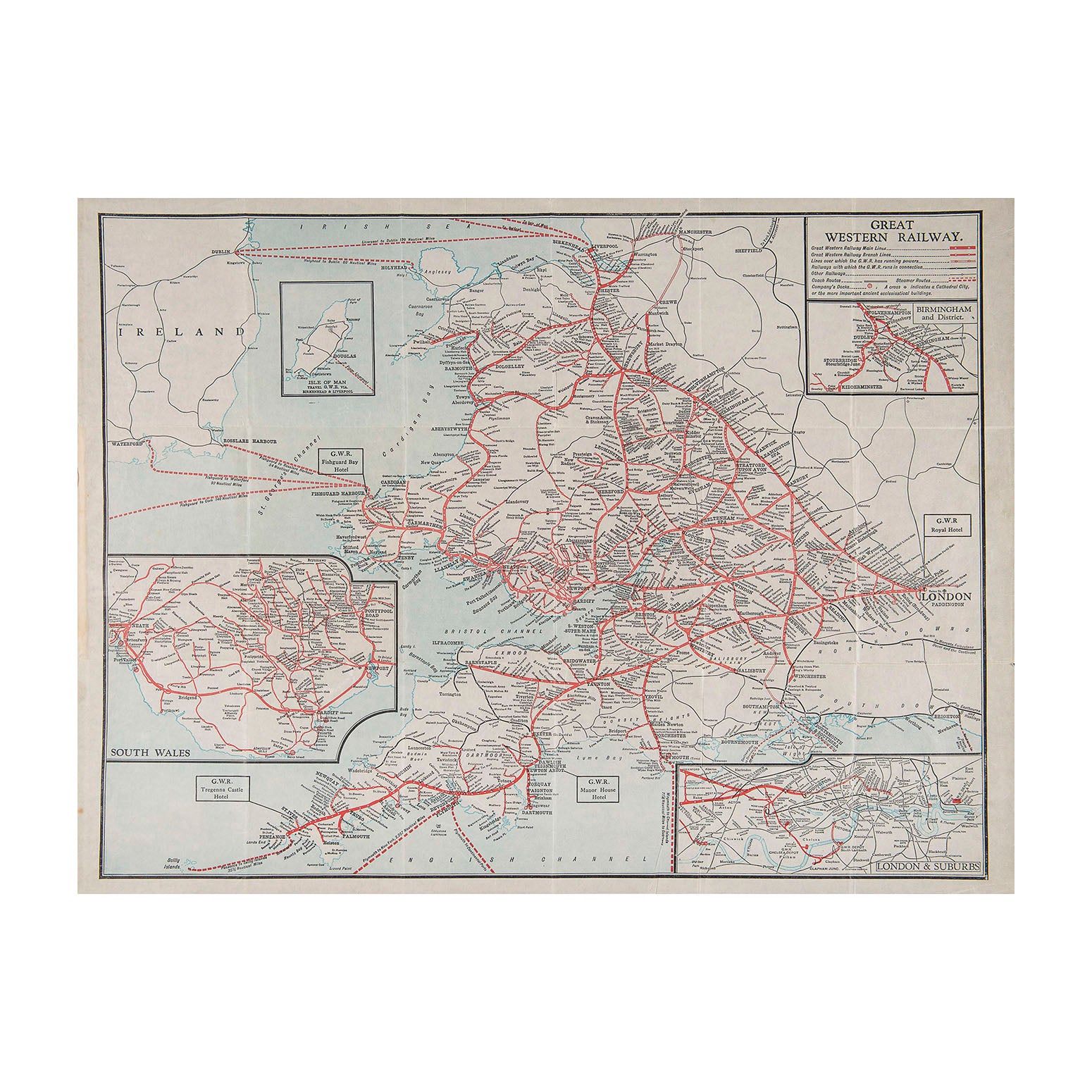
Map of the Great Western Railway, 1920s

Anon
£45.00

Please enter a quantity.

  • Condition: B+ (folded, as issued)
  • Date: c.1925
  • Printer: Emery Walker Ltd
  • Publisher: Great Western Railway
  • Size: 660 x 530 mm (open)

Original folding Map of the Great Western Railway,  c.1925

The map unfolds to show the company's rail network and steamer routes, with detailed inserts for Birmingham and District, Isle of Man, London & Suburbs, and South Wales. 

A higher resolution image is available for viewing on request.