Original folding Map of the Great Western Railway,  c.1922-26

The map unfolds to show the company's rail network and steamer routes, with detailed inserts for Birmingham and District, London & Suburbs, and South Wales.

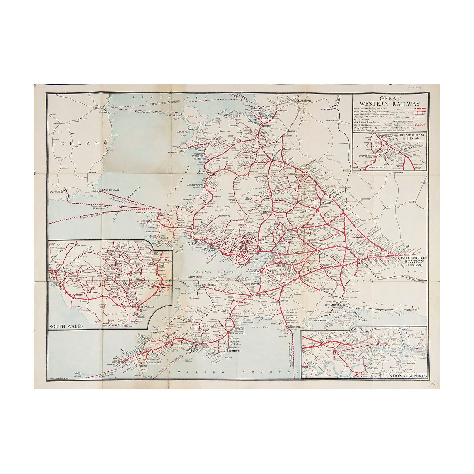
Map of the Great Western Railway, c. 1922-26

Anon
£45.00

Please enter a quantity.

  • Condition: B+ (folded, as issued)
  • Date: c.1922-26
  • Printer: Emery Walker Ltd
  • Publisher: Great Western Railway
  • Size: 660 x 530 mm (open)

Original folding Map of the Great Western Railway,  c.1922-26

The map unfolds to show the company's rail network and steamer routes, with detailed inserts for Birmingham and District, London & Suburbs, and South Wales. 

A higher resolution image is available for viewing on request.