Original folding Map of the Great Western Railway, printed on thin card, c. 1925.

The map unfolds to show the company's rail network and steamer routes, including connections for Ireland. The reverse printed with 'Distances from Paddington Station' and a selection of 'Tasteful Gifts' available from the GWR Stationery Superintendent

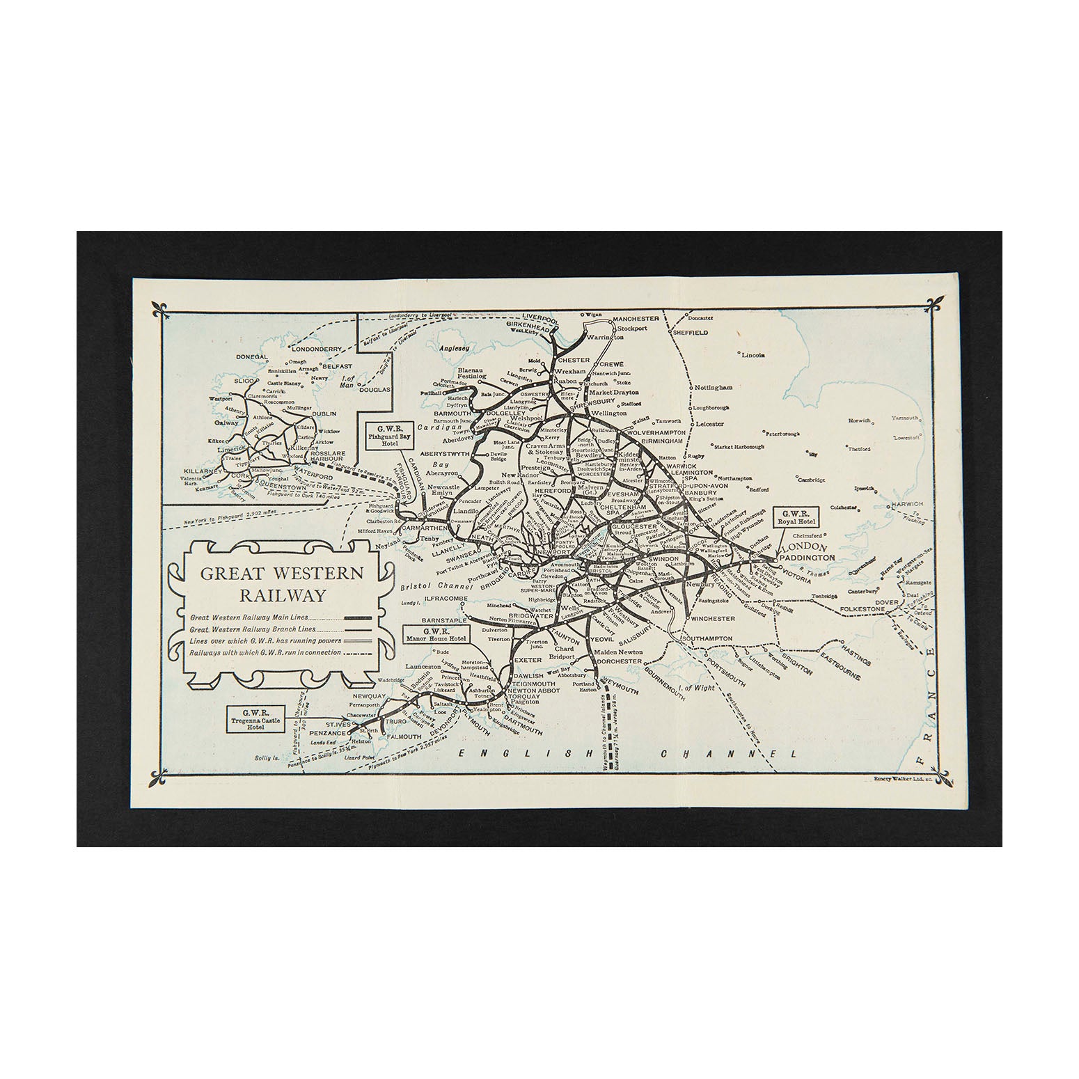
Map of the Great Western Railway (folding)

Anon
£55.00

Please enter a quantity.

  • Condition: B+ (folded, as issued)
  • Date: c.1925
  • Printer: Emery Walker Ltd
  • Publisher: Great Western Railway
  • Size: c. 250 x 160 mm (open)

Original folding Map of the Great Western Railway, printed on thin card, c. 1925.

The map unfolds to show the company's rail network and steamer routes, including connections for Ireland. The reverse printed with 'Distances from Paddington Station' and a selection of 'Tasteful Gifts' available from the GWR Stationery Superintendent. 

Higher resolution images are available for viewing on request.